Lohardagga's history dates to hoary antiquity. Lore-a-Ydaga' in Mundari means river of tears. There is reference to Kismate Lohardaga in 'Aain-e-Akbari' as well. The ruins of forts and temples of Korambe, Bhandra, and Khukhra-bhakso, are mute testimony to its rich cultural past. Local historians say that Lohardaga was once a major centre for smelting iron ("Lohar" means iron monger, "dagga" means centre).
Around 1765, the British entered this area. In 1833, when 'South West Frontier Agency" was established, the chief agent of the Governor General was resident in Lohardaga. In 1842 the Principal Assistant to the "Agent" was relocated from Lohardaga to Ranchi (then known as Kishunpur). In 1843 a Deputy Commissioner was placed and Courts were established at Ranchi but the Commissioner continued to work from Lohardaga until 1899 despite the fact that in 1854 the South West Frontier Agency was abolished. Government notified Lohardaga as a Sub Division in 1972 and as a district on 17ltl May 1983.
The District of Lohardaga is located in the south western part of Jharkhand State between 32030" to 23040" north latitude and between 84040" to 84050" east longitude covering an area of 190.82 Km2 in the tribal belt of Chotanagpur plateau.
The administrative set up of the district is divided into 5 development blocks viz : (i) Kuru (ii) Kisko (iii) Senha (iv) Bhandra and (v) Lohardaga. The district includes 5 police stations having 353 villages spread over in 67 Gram Panchayats. Lohardaga is the only town in the district.
The district is divided into two broad physical divisions viz : (i) the Hilly Tract and (ii) the Plateau Region. The hilly tract is extended in the West and North-Western parts of the district which includes the parts of Kisko, Senha and Kuru development blocks. The high hill tops of this region are known as Pat. The region is covered mainly with sal forests. The Plateau region is a part of the Gumla plateau, comprised with entire part of Lohardaga and Bhandra development blocks and some parts of Senha, Kuru and Kisko developments blocks.
This region has a number of small hill blocks covered with forests. The general slope of the district is from west to east. The main rivers of the district are South Koel, Sankh, Nandni, Chaupat's and Fulijhar etc. These are mainly Rainfed Rivers and dried up in the summer months. Some springs are also seen in the hilly tract of the district. Geologically the area in comprised with Archean Granites and Gneisses. In the uplands considerable thickness of late-rite of Pleistocene age is found in the Granite and Gneisses tracts. Alluvium of recent to sub-recent age is found in the river valleys. The most important mineral of the district is bauxite. Other minerals which are found in the district are feldspar, fire clay and china clay and have less economic importance. The major part of the district is covered with Golden Alluvium, Red and Sandy and Red and Gravelly soils. Late-rite and Red and Yellow soils are also found elsewhere in the district. The district enjoys a healthy and pleasant climate throughout the year. The annual average temperature is 230 centigrade and the district receives an annual average rainfall of 1000-1200 mm. The rainfall increases from west to east.

There is scarcely of sufficient and dependable source of irrigation because of the district being hilly. The means of irrigation in the district are river, canal, ponds and wells. About 90% of the total population of the district is dependent on agriculture. The net sown area of the district is 7744.78 hectares out of which, only 7034.20 hectares of land is under irrigation. The main crop of the district is rice followed by millets (marua, gondli and maize), pulses, wheat, oil seeds (Sarguja and groundnuts) and vegetables.
There is a total absence of large scale industries in the district. People are engaged in small scale industries like making of stone chips, bricks, soaps, oil, candles, aluminums goods, wooden furniture, earthern pots, bamboo baskets, weaving of cloths and carpets etc. The district is not having good network of communication. No national highway passes through the district and Lohardaga town is located on the state highway between Ranchi and Rourkela. Lohardaga is also connected with Ranchi by a metre gauge railway line.
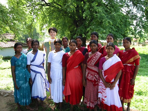
The district is lagging behind in education. Only 33% of the total population is literate. There are 2 colleges, one teacher's training school, 19 high schools and 149 primary schools in the district. About 59% of the total population of the district is tribal population, Oraon is the major tribal inhabitant of the district, the other primitive tribes are Asur, Birijia etc. still preserving their additional old culture in the district.
With the available resources and potentialities, for socio-economic growth, the district deserves proper attention for resources planning which could magnify the district in every field of development.
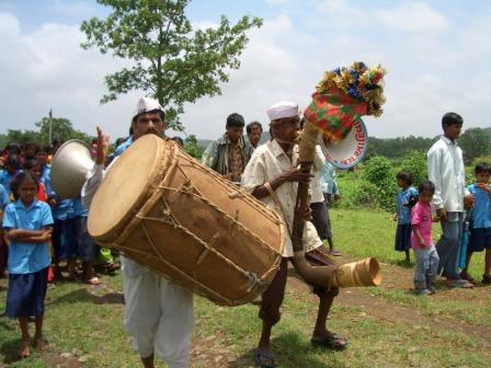
Cultural specificities:
Lohardaga district is part of the wider tribal region, called Jharkhand. The region has been a sort of loose confederation of freely associating concatenation of economically self-sufficient village communities since time immemorial. This confederation of Adivasis extended from south-western Bengal, Jharkhand, large parts of Orissa, northern Andhra, southern Madhya Pradesh, Western and coastal Maharashtra. Many Adivasis are still alive who can trace their ancestors from these parts. The Adivasis of Lohardaga had a sophisticated culture based on fine understanding of land, sustainable natural resource management, and community rights. The following paragraphs document a few singular facts about these people.
Economy:
A typical village was carved out of forest. Homestead land would generally be selected at an elevation surrounded by farmland and forests. There would be a water source- a well, a river or a pond- as close to the homestead as possible. The forests compensated the low productivity of soil to the extent of making village communities self-sufficient.
The Adivasis, therefore, came to depend heavily on forest resources such as stems, tubers, fruits, leaves, flowers, animals, timber, and herbs, for food, shelter and medicines. Despite the emergence of money economy, a part of their cash requirement is still met from non-timber forest produce (NTFP). Even today, despite education, many Munda, Oraon and Kharia Adivasis households, who own more land as compared to other Adivasis, depend upon the forests for their survival needs. There is a symbiotic relationship between the Adivasis and the forest that transcends purely material and takes on deeper metaphysical, often spiritual, connotation. "Sarna," the sacred grove, where elders are buried, is invariably located within a Sal forest.
Cultural ethos
Local people narrated another interesting feature of the Adivasi life to the investigating team. Traditionally males and females of marriageable age were first symbolically married off to Mango and Mahua trees respectively. After the actual marriage, the males would marry the Mahua and the females the Mango tree. Thereafter married couples were expected to look after their respective trees.